Old Maps & Plats

  • Collection Images
  • Collection Information
  • Collection Inventory

This collection is from the files of the firm Carolina Surveyors, Inc.  The firm chartered in 1970 as a restructuring of the firm of A.V. Blankenship, civil engineer.  Mr. Blankenship’s practice dated back to 1935 during which time he acquired miscellaneous drawing from  the firms of Wilber Smith, Blair and Drane, Inc. and others who worked with most of the prominent developers of the Charlotte area during the early twentieth century.

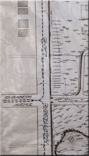
As in most cities, the development and patterns of economic growth can well be followed through the maps and plats of the period.  Many of the drawings in this collection illustrate the development of Charlotte’s finest old neighborhoods: Dilworth, Myers Park, Eastover, Elizabeth and Plaza.  Patterns of life and interests can also be found in historic mapping community. The 1917 map of Lakewood Park shows the Southern Public Utilities Street Car line which ran on the tracks towards Mt. Holly passed by the popular recreation destination where visitors could enjoy the ostrich pen, wolf cage, merry go round or refreshment parlor.

The roads and transportation systems are well documented in the historical mapping of any community. The Electric Car Lines serving the expanding suburbs of Charlotte are shown in many of the old maps in this collection. A few of the steel service poles still exist along Queens Road East but the tracks serving the Plaza Area were removed after the soldiers returning from World War One, proved they did not want to live that far out of town.  The current street car project along Elizabeth Ave. is an effort to re-build what we had once before.


Elizabeth College map  
   
IMAGE No. PROJECT NOTES SIZE ON WEB
11.01.001 Charlotte NC- Up Town Business District 1930 42x36 yes
11.01.002 Good Samaritan Hospital 1949 9x12 yes
11.01.003 Part of Dilworth         1926 23x25 yes
11.01.004 Royal Land (Morehead)  1924 31x17 yes
11.01.005 Morehead St. Bridge      1916 35x31 yes
11.01.006 Trolley Pole Detail        1912 12x19 yes
11.01.007 Plat of Dilworth             1924 49x33 yes
11.01.008 S. Church @ W. Third St 1956 28x20 yes
11.01.009 Women's Club Dilworth  1923 8x13 yes
11.02.001 Charlotte NC- Myers Park MPCC Golf Course 1920 36x26 yes
11.02.002 MPCC Swim Pool 1921 36x24 yes
11.02.003 Polo Grounds 1941 32x19 no
11.02.004 Myers Park Sales Map 1921 18x12 yes
11.02.005 Myers Park Location Map   (?) 15x9 yes
11.02.006 Myers Park Plat          1930 16x13 yes
11.02.007 Myers Park Plat          1916 19x14 yes
11.02.008 Myers Park Plat          1919 19x19 yes
11.02.009 Myers Park Plat          1927 20x18 yes
11.02.010 Myers Park Plat          1924 22x13 yes
11.02.011 Areoplane View M. P.  1921 82x27 yes
11.02.012 Sherwood Ave Plat      1926 34x17 yes
11.02.013 Myers Park General Map 1930 72x42 yes
11.02.014 Queens Rd X-section yes
11.02.015 Wachovia Park Rd (Graham 1957 yes
11.03.001 Charlotte NC- Eastover Subdivision Plat 1933 42x36 yes
11.03.002 Elizabeth College 1915 42x34 yes
11.04.001 Charlotte NC- Misa Atherton Mills 1919 26x21 yes
11.04.002 Char.Country Club 1929 56x42 yes
11.04.003 Lakewood Park 1917 42x30 yes
11.04.004 Atherton Area              1901 11x15 yes
11.04.005 Charlotte Area Rails & Roads (?) 17x10 yes
11.04.006 Johnson C. Smith Univ.   1951 43x36 yes
11.04.007 Atherton Mills                1919 38x26 yes
11.04.008 South Side Land            1925 16x11 yes
11.04.009 Charlotte Quarry Co.      1913 12x13 yes
11.04.010 Hatch Property              1919 21x12 yes
11.04.011 Carolina Crushed Stone  1927 50x44 yes
11.05.001 Other Cities UNC Chapel Hill 1920 30x30 yes
11.05.002 Princeton Univ (?) 12x14 yes
11.05.003 Harvard Univ (?) 16x12 yes
11.05.004 UNC (with Topo) 1920 30x30 no
11.05.005 Gaston Farm Map (HEW) 1931 32x19 yes

Home    About Us    Contact Us    Prints    Collections    FAQ's